Thank you for visiting! Calibrate is not an interactive installation. The machine is constantly working - sometimes drawing, sometimes collecting and computing data - regardless of whether it appears to be moving. Please do not attempt to “make” the machine move - it will ruin the mechanics. Please do not push any buttons or pull on the wires. Please do not climb on the frame.
Sometimes the temperature and humidity affect whether the media flows. This is part of the drawing process - the stylus pushes and moves the media (when it’s not frozen) in addition to dropping it.
Thank you!
Calibrate
University Design Research Fellowship, Exhibit Columbus Exhibition 2021 New Middles: From Main Street To Megalopolis, What Is The Future Of The Middle City?
OverView
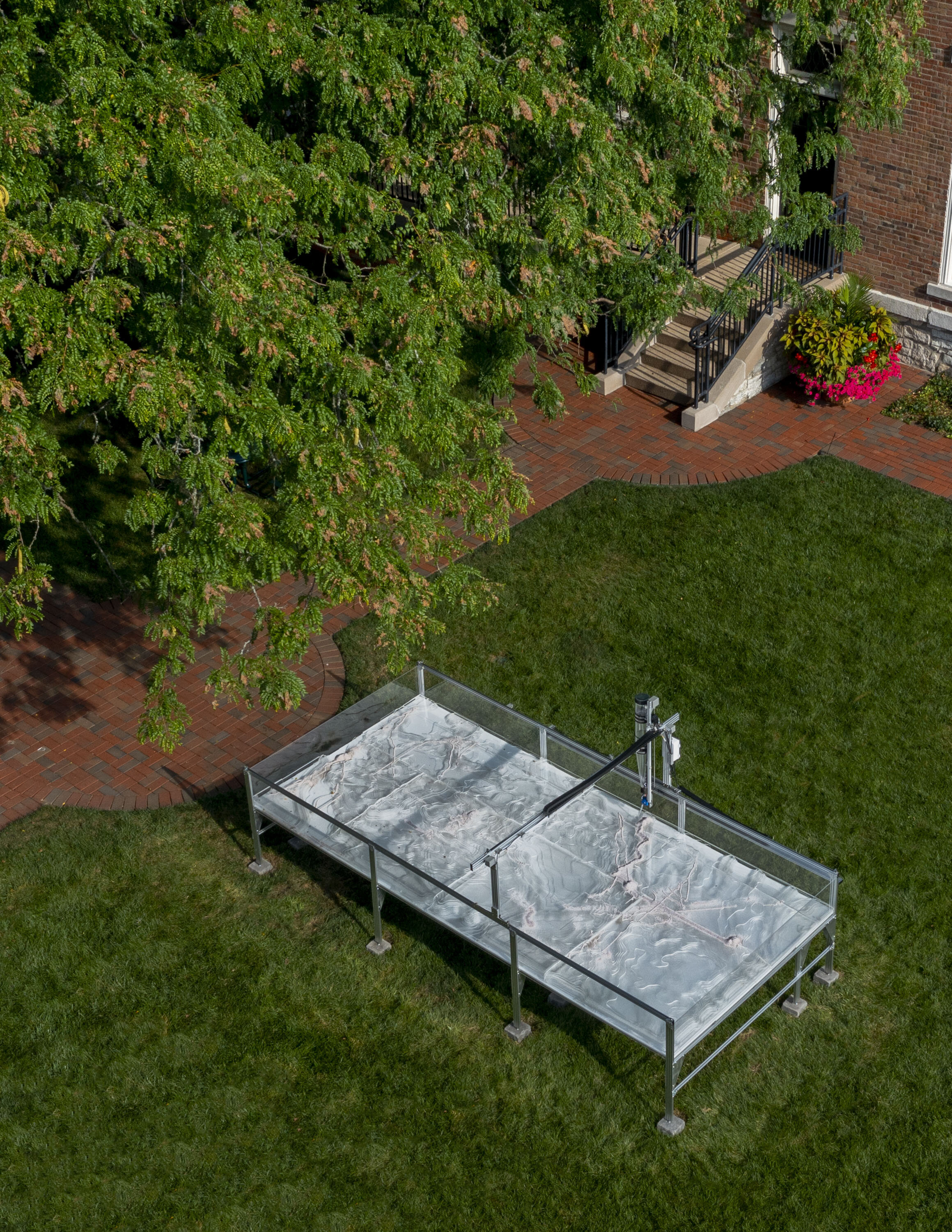
Calibrate is an apparatus for registering and perceiving multiple scales of intricate, accumulated environment data gathered from across Columbus and its environs. This installation in the courtyard of Franklin Square, home of the Heritage Fund of Bartholomew County, records the cultivated ecological layers of a city rich in making, creativity, and innovation over multiple, disparate timescales—from geologic time to real-time sensing data. The aggregation of thousands of years of glacial motion, together with the Ohio River watershed ecosystem has long nourished anthropogenic ingenuity for industry, agriculture, and technology.
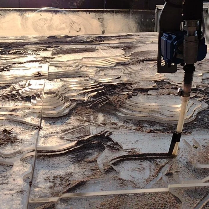
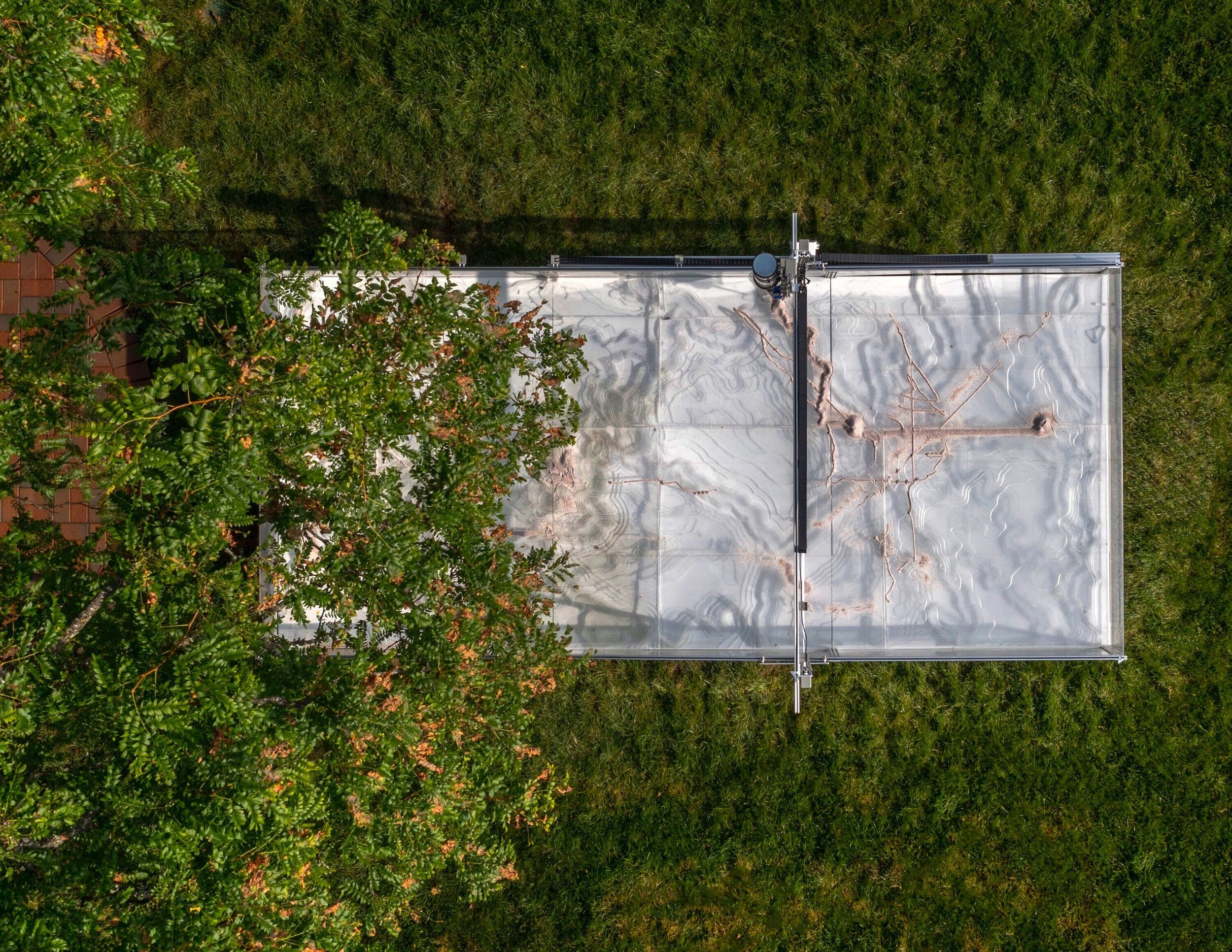
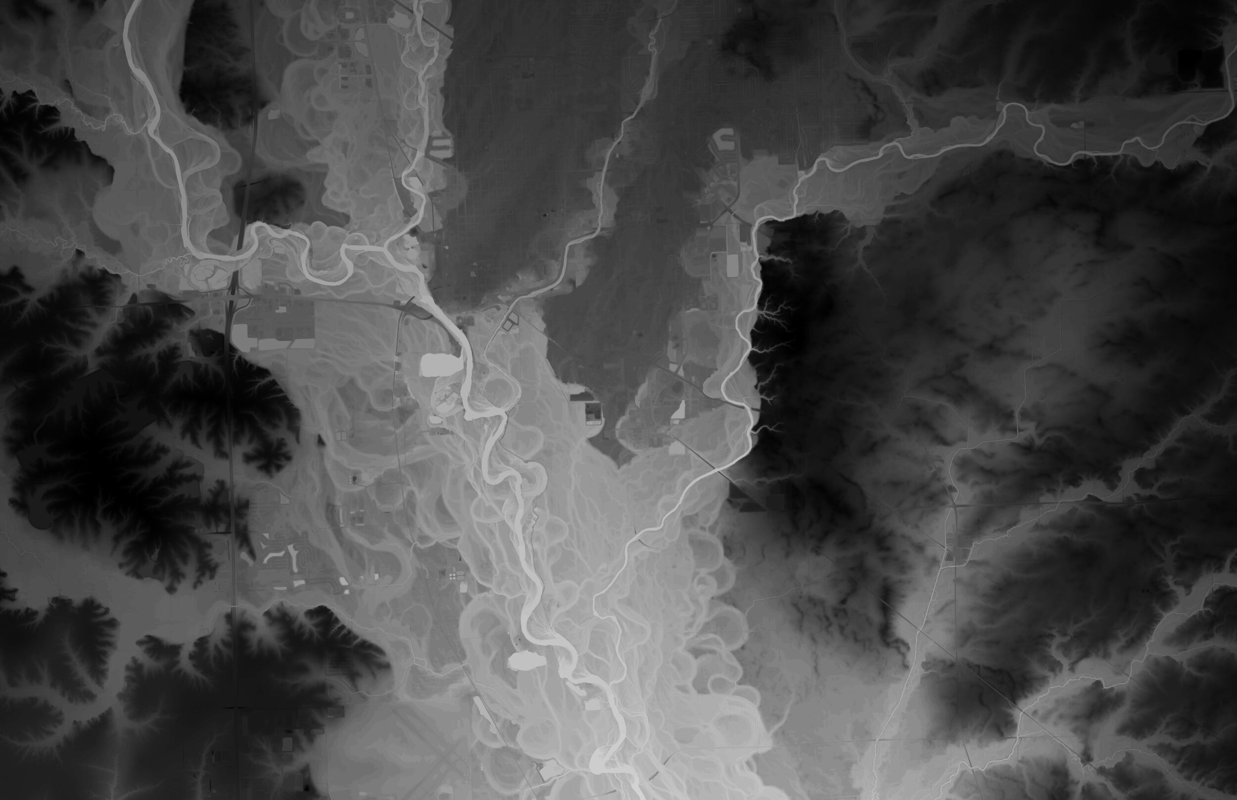
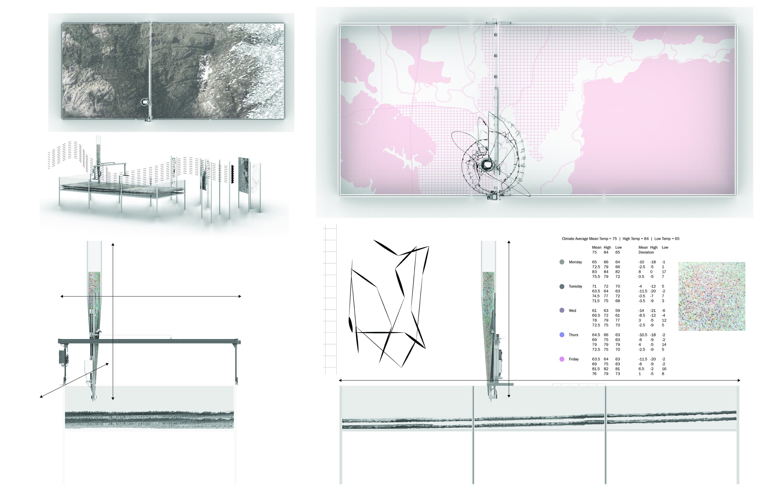
Calibrate is a kind of drawing machine. Its armature is a large, transparent repository with a foundational acrylic terrain base based on the landscape of Indiana. The base, or “canvas,” consists of two layers or systems. The lower layer is a mapping of groundwater availability, relating to the unseen aquifer system underlying our landscape. The upper layer is based on a mapping of the topography of surface bedrock.
Above the repository, a hopper-stylus on a robotic gantry methodically deposits and disperses media onto the canvas, choreographed by environment data. The data is collected from publicly available sensor networks such as temperature, humidity, solar radiation, precipitation and river currents. The data is processed, translated and re-calibrated to direct the machine’s movements. As the data changes, the media accumulates and repositions, continuously redrawing and remapping the underlying terrain. Being situated outside in the environment, the machine, the media, and the canvas are all additionally influenced by the site-specific, direct influences as well - such as sun and shade, ambient lighting, rain, wind, insects, birds, humidity and people.
Visitors will see the gantry’s movement as a slow drawing, which might also be interpreted as a kind of performance that makes visible the interconnected ecological information that centers Columbus within a long timeline.
We can program data into a virtual simulator to get an idea of how the drawings will evolve over time, however slight local variations can influence change. The nature of the machine, the exposure of the canvas, and the response of the hopper-stylus to small adjustments in addition to the environment data and variation in the terrain all come together to create the drawing in motion, over time.
Calibrate - dissected
The Frame
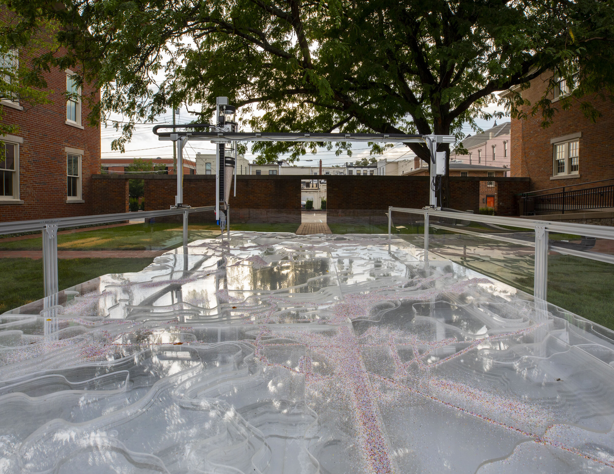
The 2 meter x 4.5 meter frame is constructed of aluminum v-slot linear rail, braces, and hardware familiar to CNC and 3D printing machines. The v-slot construction provides a channel for the gantry to move along as well as grooves to hold the outer acrylic panels. The materiality was chosen for its recognition with industrial mechanisms and technology which are part of the heritage of Columbus.
The “canvas”
Nestled within the frame is an acrylic terrain model that serves as a canvas for the evolving drawing.
The upper portion of the model is a 3D representation of Indiana surface geology derived from LiDAR. It shows variation in elevation as well as variation in landforms.
The lower portion of the model is derived from a mapping of groundwater availability which are related to the aquifer system underlying the Indiana surface. The mapping creates a variety of containers, pockets, and channels. Water from precipitation, condensation, and even the sprinklers on-site seeps through the upper portion, collects, and runs out through seams and the aluminum slotting.
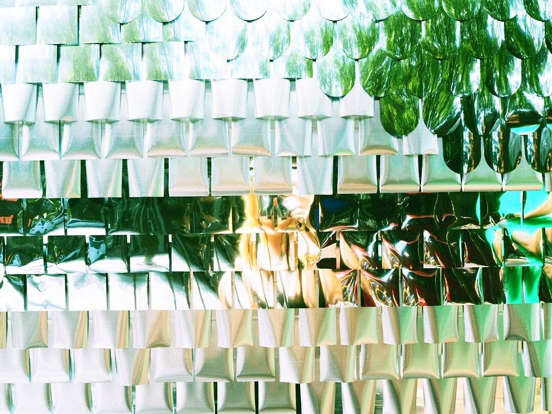
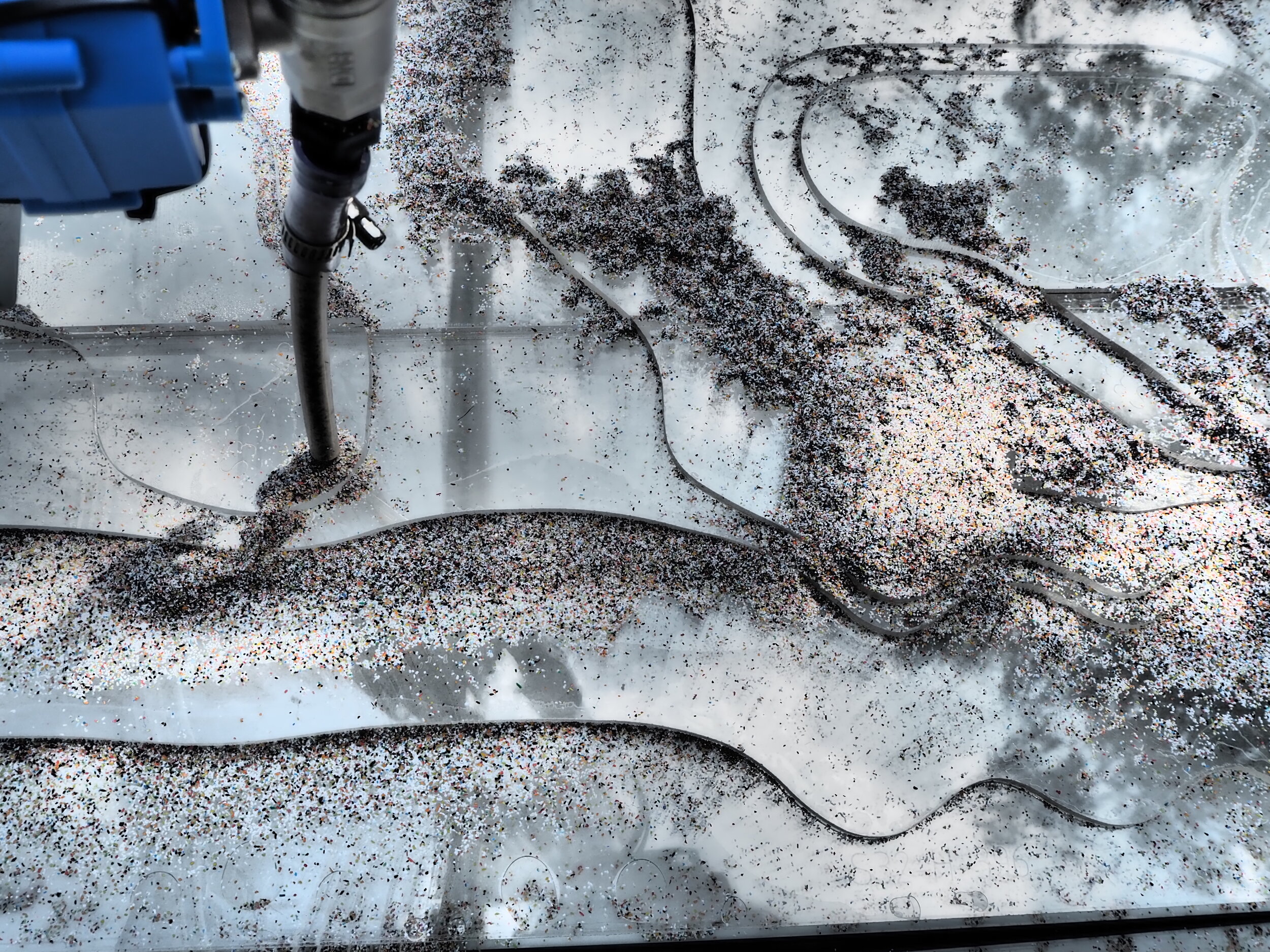
The canvas is constructed from 40 4’ x 8’ sheets of 1/4” acrylic. Each sheet was milled on a CNC, etched with numbers to define the layer, piece, and placement. The pieces, like a giant puzzle, were then assembled and chemically welded into a series of tiles. The acrylic provides opportunity to view below the surface - a glimpse into the unseen terrain underlying. Additionally the reflective and refractive qualities change the optics of the static terrain depending on lighting conditions. Peering into the work, you may even catch a glimpse of yourself, superimposed in the drawing.
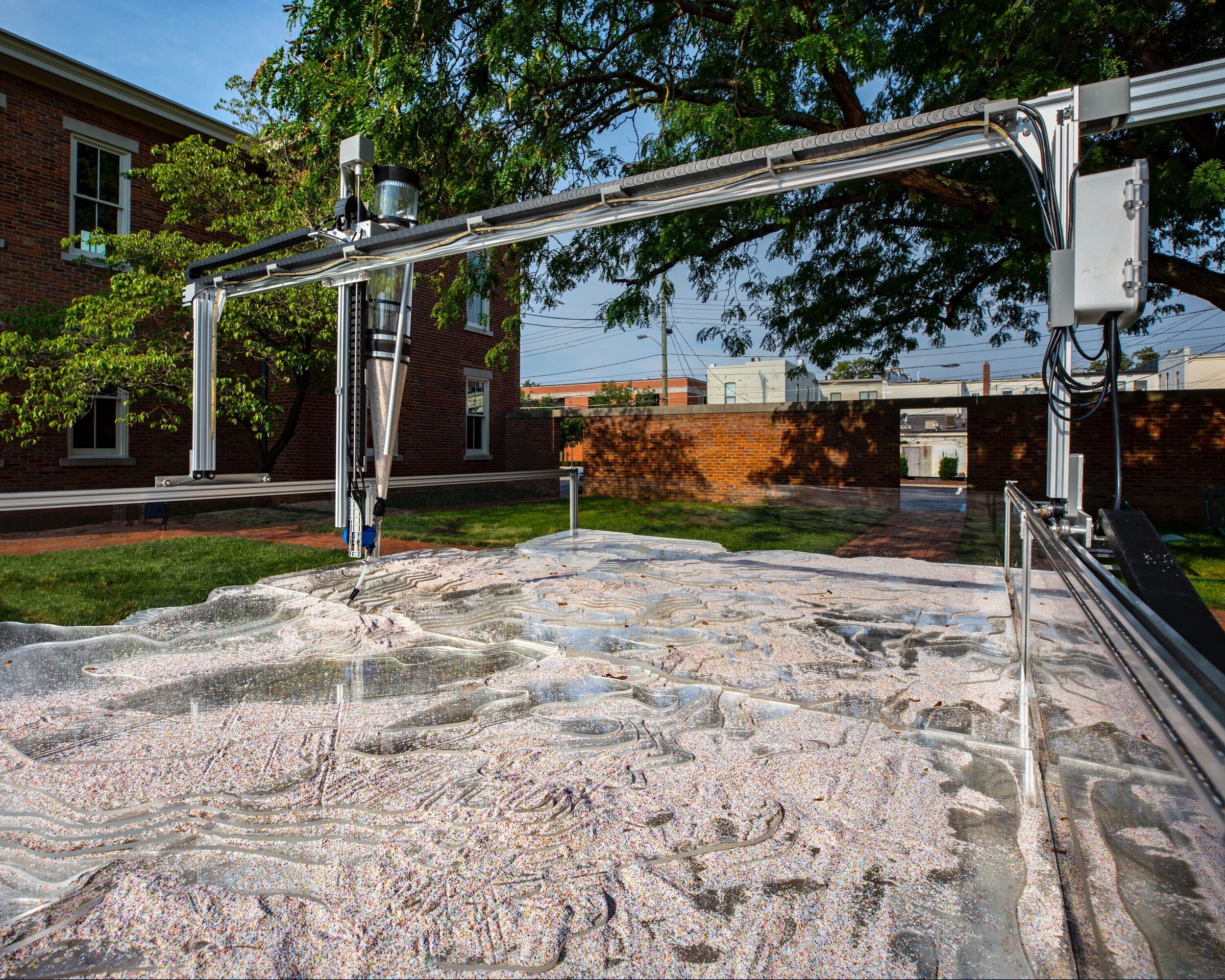
The gantry and the hopper-stylus
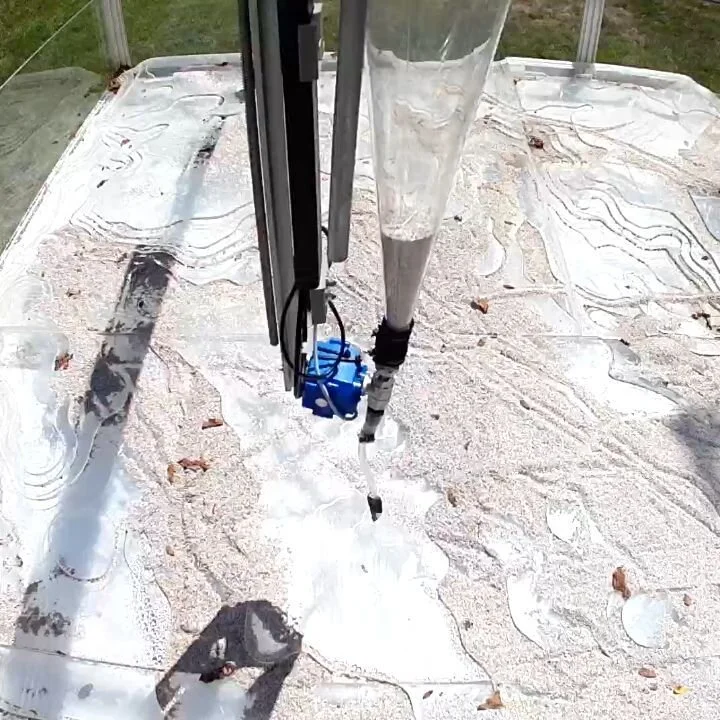
The gantry holds a z-axis hopper-stylus that moves across the aluminum frame, atop the acrylic canvas. This piece is a re-configured FarmBot - an open-source, precision agriculture machine that includes not only the material parts and electronics, but also software and coding. While the FarmBot was created to seed, water, nourish and weed according to scheduled events and localized sensor readings, Calibrate re-configures the build and the programming to dispense, disperse, aggregate and carve through re-interpretation of data collected from environment sensors embedded in the Columbus and surrounding area landscape.
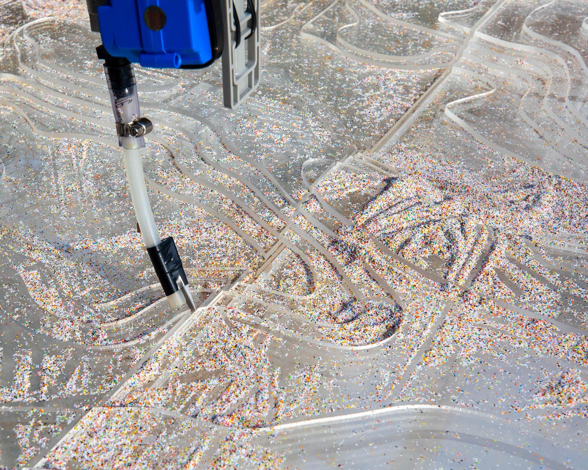
The hopper-stylus is a tool attached to the z-axis that collects, distributes, and disturbs a recycled plastic grit media. The main body of the hopper is a modified Imhoff Cone, typically used to measure settleable solids - such as river sediment. The cone sits below a motorized fan, which enables the hopper to pick up and re-distribute media from the bed below. Below the cone is a motorized ball valve that controls the flow of the media onto the canvas and an angled stylus tip that shapes and marks the media as it moves along the base.
The recycled plastic grit media is typically used for sand-blasting, however is also used for river sedimentation modeling. The media will move as forces (water, wind, the hopper) influence, constantly re-configuring the base terrain.
the data
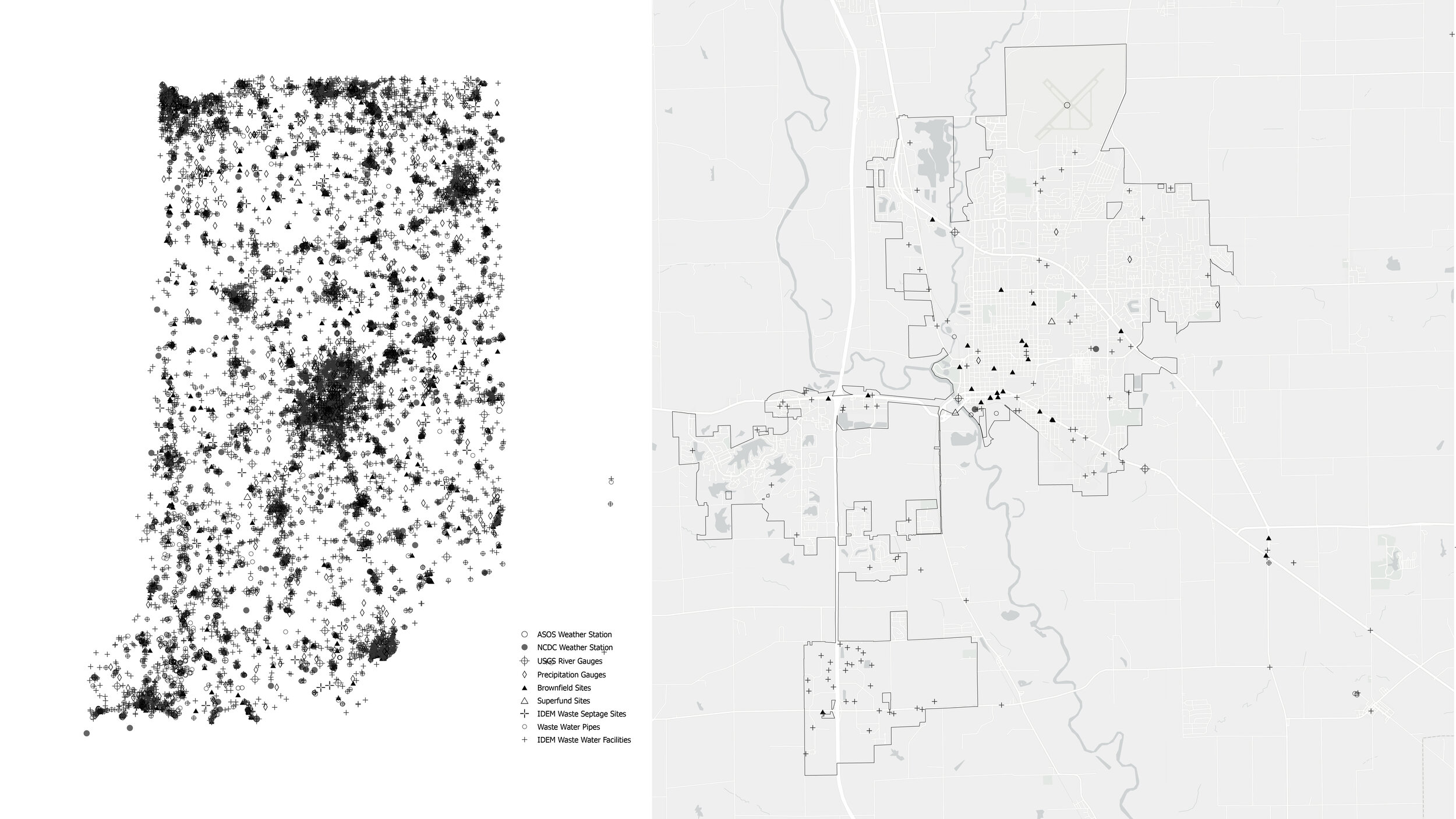
Environment sensors are embedded throughout the landscape. Some of these we interact with every day - for instance, the weather application on your smartphone tells you how hot or cold it is outside. Some are more hidden, or rather less interacted with, such as gauges that read the current and conductivity at points along our waterways. This data is reported at various intervals - some every 15 minutes, some once per day or week - recorded to publicly-accessible databases. Each set of data has its own values and unit depending on what it is measuring. Through coding and programming, Calibrate collects this data and re-interprets the values into instructions that create the drawings.
At this time, Calibrate operates according to 5 variables - temperature, precipitation, humidity, solar radiation, and river currents. The data is calibrated through use of climate normals and comparisons to averages.
In addition to drawing operations being driven by sensor data, the machine and the media are directly impacted by localized, site-specific influences such as micro-climate conditions created by the courtyard itself - gusts of wind blowing leaves into the drawing, humidity created by evening sprinklers causing the media to crust, and even a hand that traces a line into the media.
the drawings
The output of Calibrate is both a singular drawing-in-motion evolving over time and a series of ephemeral drawings. While we can simulate how the data might drive operations to create a drawing over time, because the apparatus is situated in Indiana, in Columbus, in the Heritage Fund Courtyard, the actual drawings are much different than the simulation.

[link to live stream / timelapse forthcoming]

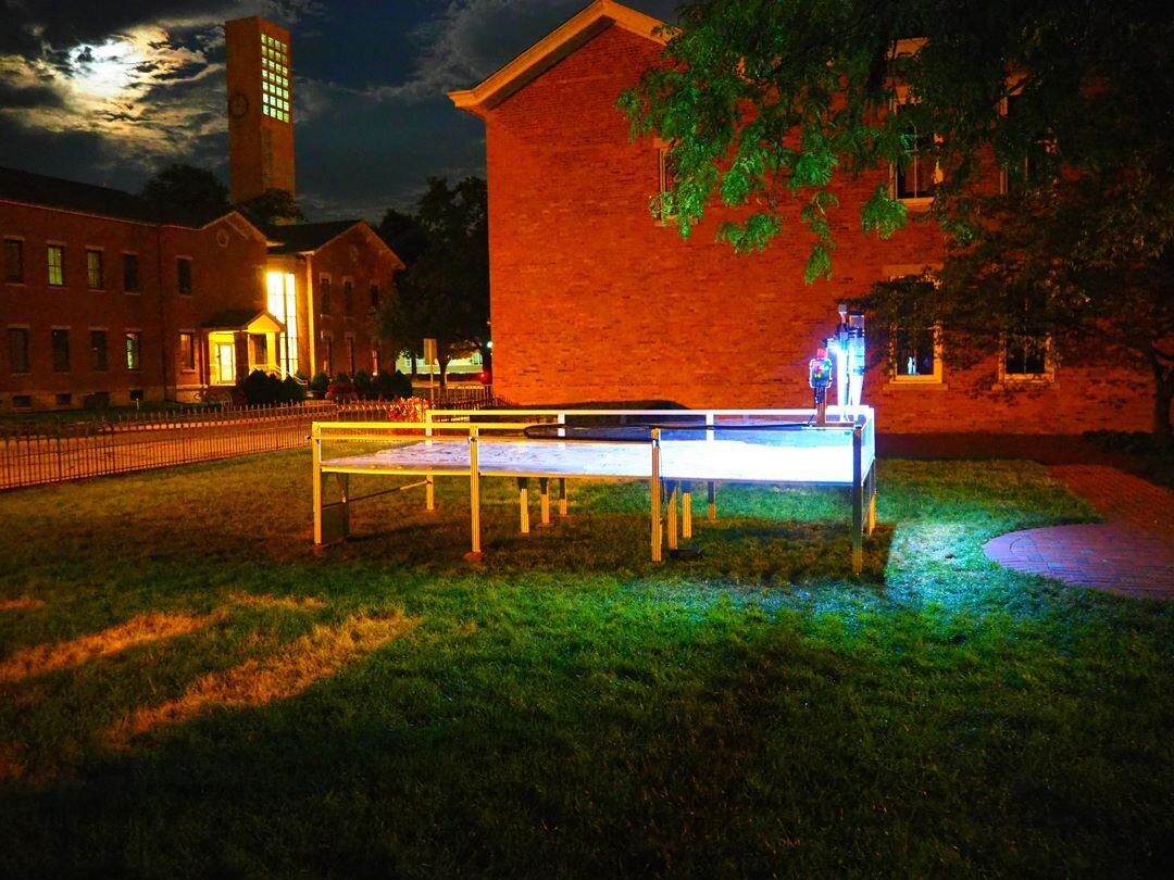
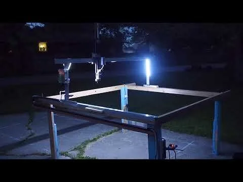
Calibrate at night in the Franklin Square Courtyard. Image by Natalie Yates, 2021.
behind the Idea
The concept for Calibrate evolved over a series of discussions that included my research in time-based landscape analysis, the exhibition theme - New Middles, and exploration of the emergence of Columbus, Indiana.
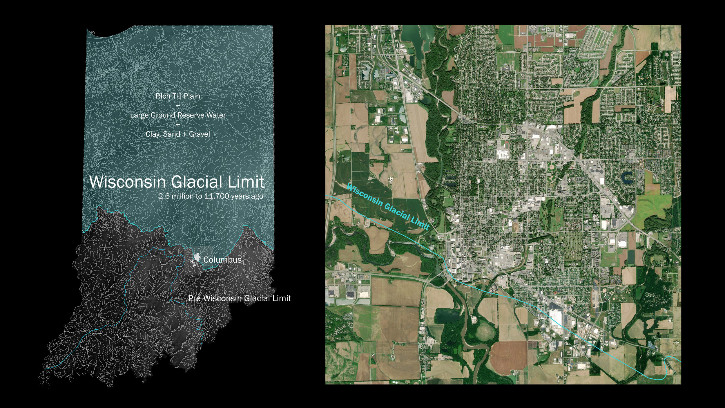
Columbus is a city of making, creativity and innovation cultivated by ecological and environmental layers aggregating over multiple, disparate timescales. Over a larger timeline, Columbus straddles the Wisconsin Glacial Limit - a line that delineates the reaches of the last ice age and the Laurentide Ice Sheet. The processes of glaciation developed several key resources - sand and gravel deposits, groundwater repositories, and fertile agricultural soils - and it shaped and changed the landscape dramatically. This longer scale of time and process set up the framework for human expansion - transportation, economy, industry, making - the anthropogenic timeline. As we continue to understand, the Anthropocene has also influenced and changed our environment. We can understand these changes through the comparison of data collected, and calibrated, over time.

Watch the Design Concept Presentation from March 2021.
PROCESS
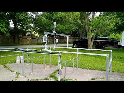
The hopper-stylus distributes and disturbs plastic grit media, creating a constantly evolving terrain. Image by Natalie Yates, 2021.
BUILD GALLERY
Many Thank Yous!!!
This project was made possible through the help and support of many people… and I’m sure I am forgetting some.
The fabulous curators - Mimi Zeiger and Iker Gill
Exhibit Columbus and Landmark Columbus Foundation - Anne Surak, Ben Valentine, Bethany Ferril, Jamie Goldsborough, Richard McCoy and Elizabeth Kubany; Hadley Fruits for documenting and making us look good!
The Heritage Fund of Bartholomew County at Franklin Square for their beautiful courtyard site.
Janice Shimizu and Josh Coggeshall - my secret weapons.
Dan Eisinger and Zeelyn Stutz.
The fantastic, tireless Ball State Landscape Architecture Students - Amelia Zaharako, Nathan Horlander, Celeste Drake and Raynor Eddy.
Martha Hunt - super supporter. Marilyn Davis for wrangling trucks and other necessities.
Heavy lifters: Chris Marlow, Malcolm Cairns, Jeremy Merrill, Miguel San Miguel, Kathy!
Dave Ferguson, Tarek Mafouz, Nina Davis. Ben Bascom.
Ball State University R. Wayne Estopinal College of Architecture & Planning [CAP] and the Department of Landscape Architecture; BSU Maker Hub at MadJax
Shannon, Nikki, Cathy, Andi, Sarah, Bess, Cheyenne, Eli.
instagram #calibrate_ny